|
Loading
|
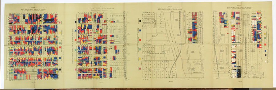
Apprehending Darkness in the Shadows“Wage Map,” from Hull House Maps and Papers: A Presentation of Nationalities and Wages in a Congested District of Chicago. New York: Thomas Y. Crowell & Co., [1895?]. (Gift of Charles Rosenberg)
While much later than most of the items in the exhibition, this wage map, drawn by the Hull House Settlement, exemplifies the socioeconomic factors that helped encourage vice districts. Households earning higher wages tend to be clustered on the west side of the river, close to “legitimate” retail districts, while households earning from less than $5.00 to $10.00 a week, many headed by African Americans, are situated next to brothels (and likely saloons and pawnshops as well) on the east side. This map of the rapidly-expanding metropolis of Chicago could plausibly be depicting other 19th-century cities as well.
|
||